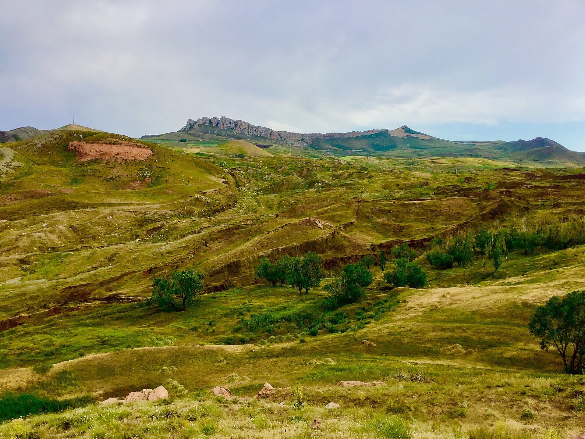
Travelers searching for Noah's Ark Turkey head to the Durupınar site, located roughly 16 kilometers southeast of Doğubeyazıt between the villages of Telçeker and Üzengili. After flying into Ağrı or Iğdır airport and reaching Doğubeyazıt, you will need a private car or local taxi, turning south off the main Doğubayazıt to Gürbulak highway onto a paved village road for about 3.5 kilometers. Because the main attraction is viewing the boat-shaped earth formation from an elevated hillside terrace and walking down toward the ridge, a stop here takes less than an hour.
Late spring through autumn offers clear visibility across the valley toward Mount Ararat, while early morning or late afternoon light defines the raised edges of the earthwork best for photographs. Viewing the outdoor geological formation is free and does not require a ticket or the Museum Pass Turkiye. Although a small visitor building stands beside the viewpoint with old photographs and newspaper clippings, its maintenance and opening hours are irregular and unconfirmed online, so plan your stop primarily for the open-air overlook and check locally before you go.
While religious traditions link the Genesis and Quranic flood narratives to the broader region of Mount Ararat, this specific site sits about 29 kilometers south of the volcano's summit on the lower slopes of Mount Tendürek. On September 11, 1959, Turkish Air Force Captain İlhan Durupınar spotted a symmetrical, hull-shaped outline on aerial survey photographs, sparking decades of visits by explorers such as former astronaut James Irwin in the 1980s and geophysical teams from Turkish and international universities. In 1987, the Ministry of Culture and Tourism registered the area as a protected natural monument and open-air museum.
Because the Durupınar formation sits just a short drive southeast of Doğubeyazıt, most visitors pair it with the architectural and natural sights clustered around the district center.
| Place | Type | Time needed | Best for | Entry |
|---|---|---|---|---|
| Noah's Ark | Protected geological formation | n/a | Durupinar boat outline and Ararat views | Free |
| Mount Agrı | Volcanic mountain peak | n/a | Biblical legend backdrop and trekking | n/a |
| Ishak Pasha Palace | Ottoman palace complex | n/a | 18th-century architecture and harem | Ticket |
| Ahmet Hani Museum | Cultural and city museum | n/a | Kurdish literary history and ethnography | Free |
The boat-shaped landform, officially known as the Durupınar site, lies between Telçeker and Üzengili villages about 16 kilometers southeast of Doğubeyazıt and 3.5 kilometers south of the highway toward the Iranian border. It sits on the foothills of Mount Tendürek, roughly 29 kilometers south of the summit of Mount Ararat.
No, mainstream geologists and archaeologists classify the 157-to-164-meter formation as a natural geological structure made of limonite and mudflow deposits shaped by landslides and erosion. However, its ship-like proportions and proximity to Mount Ararat continue to attract visitors interested in the flood legend and geology.
Most travelers spend 30 to 45 minutes viewing the boat-shaped outline from the upper hillside terrace, taking photographs of Mount Ararat to the north, and walking down the slope toward the ridge. Including the drive from Doğubeyazıt, the detour takes roughly an hour and a half.
No, the outdoor formation is in an open protected zone and is free to view without a ticket or Museum Pass Turkiye. A small visitor building stands by the viewpoint, though its opening hours are irregular and cannot be confirmed online.
Because public buses do not run up the 3.5-kilometer village road to Telçeker and Üzengili, hiring a taxi in Doğubeyazıt is the easiest option. Many drivers offer a combined half-day fare that covers both the Durupınar site and Ishak Pasha Palace.
Early morning and late afternoon are the best times, because low-angle sunlight casts shadows along the raised outer rims of the formation and makes the hull shape stand out from the surrounding hillside. Midday sun can flatten the contrast of the brown earth and rock.
Sources: agri.ktb.gov.tr, agri.gov.tr, en.wikipedia.org
Last reviewed: